Wednesday, April 21, 2010

Glagah Beach, from Lagoon Scenery to Agro Tourism

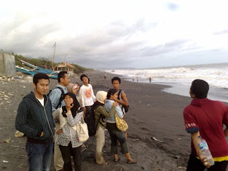
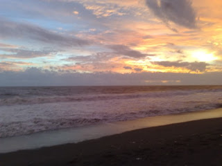
A coastal plain of the field will soon be greeted when visiting Glagah Beach. Spaciousness of this coastal plain to give you the opportunity to spread his views to all directions. Looking straight ahead, you can see the horizon very long ocean and the sky. While the beauty of the bend of the coastline will pamper the eyes when their eyes to the west or east.


Coastal plains of the field and a long coastline also gives you a number of alternative locations to see the beauty of the beach. Each location has a different feel as though they are located in one area. At each location, you can enjoy all the beauty of the beach with ease, there is absolutely no giant rocks which sometimes prevents eye.

The first location is very appropriate to view overlooking the beach is a location that will be the port the next few years. You can find the place when the first branch of the postal charges, the sign is a signpost that read PP. Meeting streams and the ocean waves can be seen full harmony with the view up there is a substation there.


Throughout the first location to a few hundred meters to the west, you can find a lagoon with a water flow toward the river mouth. Laguna beach is divided into two areas, locations that are still covered by some beach plants and grasses and sand dune area that directly borders the ocean. You can cross to the sand dune area through a connecting bridge which is located not far from the river mouth.

Walking further to the west, you can see the activities of local people and some people fishing. They are standing in line, along the coastal line holding their fishing rods. Sloping beach area that gives grace enough fish in large numbers. A number of stalls offering seafood there too, serving a variety of menus that are worth trying.

Besides the beautiful beach scenery, Glagah Beach also has a variety of coastal tourism facilities. One is the motor cross area which is located right on the beach with an area large enough, to give satisfaction for those of you fans of this sport. Meanwhile, the asphalted road that connects Glagah beach with other beaches can be used as an arena of sport bike.

You can even enjoy the beach facilities with visiting plantations agro Wanadri Kusumo. There, you can observe the cultivation process of elixir, such as dragon fruit and flowers Roselle. In addition, you can also hire gethek, canoeing and rowing duck that could be used for tours of the lagoon or just cross over the wooden bridge towards the sand dune area on the beach.


Tired of traveling, you can rest in the huts in the area of plantation lesehan Wanadri Kusumo. A number of exotic food and drink menu are worth trying. You can taste the fresh dragon fruit juice and is known to cure various diseases, or order Roselle flower syrup that will quench your thirst and neutralize various toxins in the body.

To enjoy the whole panoramic view Glagah beach, you can go across the two alternative roads. First, walk through the streets of Bantul, south and turn right into the path of Bantul - Purworejo after arriving in Palbapang. Second, walking west past the trajectory path of Yogyakarta - Wates - Purworejo and turn left after the signpost to find Glagah Beach. You can use a personal vehicle for easier access.


Travel to the beach is not as difficult as the way to beaches in Gunung Kidul. The roads are impassable and there was not much inclined flat so you can climb and he will teach her to relax. Trajectory toward the town of Purworejo it also connects Glagah with other beaches in Kulon Progo Regency. So, once a row, two of the three islands are exceeded, you can visit other beaches afterwards.

Read More......

Kwaru Beach : A New Tourism Place In Bantul

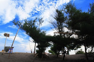
Kwaru Beach is located in Bantul, Yogyakarta, 8 miles west of Samas Beach, or about 4-5 miles east coast Pandansimo. The beach has a distinctive feature of the beaches on the southern island of Java, namely black sand. The beach is covered with lots of pine trees, so if the heat can take shelter under it. Moreover, if while enjoying a variety of fresh sea fish dishes can be ordered any time at local cafes.

kwaru beach, kwaru, pantai, sunset at kwaru

Kwaru Beach located in Srandakan expected to become an alternative tourism Parangtritis. This beach is supposed to be optimally suitable tilled wisdom of local communities so as to attract the tourists. Also expected are also getting better beach management and involve local stakeholders in Kwaru.

kwaru beach, pantai kwaru di bantul

According to information of citizens, on Sundays Kwaru beach full of tourists who want to enjoy the beauty of the beach and enjoy the culinary dishes of sea fish. We provide a variety of fish that is enough food taste invites tourists with affordable price, said one manager Mbah Ipan food stalls. Mbah Ipan also requested that the means streets of Bantul Regency which is still too narrow to pass the tourists. He expects to soon be widening the road and the construction of several tourism facilities.


Unfortunately, the beauty of the Kwaru beach coastal erosion threatened by the existence of an increasingly occupied the land. Every year the waves erode the beach is always so when it was approximately 150 meters of land affected by coastal erosion.


pengunjung pantai kwaru

Read More......
Thursday, April 15, 2010

Ceremony : Saparan Bekakak

Events Saparan Bekakak is of great cultural agenda so that its presence is awaited by the people of Yogyakarta and its surroundings even by domestic and overseas tourists who are in Yogyakarta.In this year Saparan Bekakak expected to be more lively than in previous years. In addition to carnival participants are expected to reach approximately 5000 more personnel, also with the presence of 4 soldiers and 20 horsemen elephant will give special attraction for visitors or tourists.


Bekakak Bride, so society called the two couples bridal doll which is always in the wine and the butcher bekakak ceremonial. This doll made by residents of high yielding varieties of rice flour, in which given (syrup) juruh Java sugar. The existence of this stems from bekakak “syarati” that must be fulfilled to overcome falling fatalities in the limestone mining area in the Gamping Village, in every second month of Java, Saparan.

Formerly Gamping community livelihood limestone miner. Obtained answers, recurring disasters that can be overcome with one condition, Gamping society must sacrifice two pairs of bride. Finally, make a mock wedding in rice flour as loroblonyo. In the body of the content juruh, Like a wedding, the bride made all the offerings which include complete consists of cone (tumpeng), rooster still alive, flowers and ‘dlupak’.


On dates between 10-20 Sapar or near full moon, two bridal pairs of offerings and their citizens paraded around the village and taken to the center of the limestone miners earlier times. Bridal couple was taken to Mount Ambarketawang, the others a couple to Mount Kliling. After the prayer, the bride bekakak slaughtered. Every part of his body and then divided and contested citizens. It is said that after being given offerings of two couples bekakak, the number of accidents has dropped dramatically.

Read More......
Tuesday, April 13, 2010

Sadeng Beach, An Ancient Estuary Bengawan Solo

In ancient times the Solo River flows quietly from the upper reaches in the north until it empties into the Coast Sadeng now in Gunung Kidul Regency. However, four million years ago, a geological process occurs. Australian Plate Java goes down, causing the plateau slowly lifted the island of Java. River flows eventually could not resist until the flow finally turned to the north. Ended up staying on track trail that slowly dries up because there was no water. This area became rich in limestone hills, which according to some research, originally a coral reef under the sea surface.


On the way to Sadeng Beach, a few hundred meters of flow path can be enjoyed Solo Ancient landscape. Flow path can be seen after arriving at the blue signpost reads "Girisubo - Capital District." Pause at the edge of the road to the beach or walking slowly is the best way to enjoy the scenery used this genre, and to provide more opportunities immortalize it with a camera.

Appear two high limestone hills stretching flanking a lowland which it was originally a path of flow. Lowland arable crops farming land is now a local resident was beautiful winding, stretching as far as 7 kilometers to the north, to the region in Wonogiri Pracimantoro.


When you've reached the shore, then the different views will be found. Coastal areas have also experienced changes, such as the flow path that is now the fields of population. Sadeng Beach is now a fishing port in Yogyakarta the most advanced, proven with complete supporting facilities, such as motor boats which are larger in size, terminal fueling, lodging house where the fishermen to fish auction and cooperatives.

Expanding Sadeng as fish port also has its own story. Around the year 1983, a group of fishermen fish from Gombong, Central Java, came to this place. They consider Sadeng big potential as a place to fish. The challenge was quite tough, not only because of the great southern ocean waves, but also the trust of local residents who do not allow to sea and the coast is reputedly mistic.

Visiting Sadeng like witnessing an evolutionary process. During the trip, could be remembered for the evolution of lowland Solo Ancient flow path from where the flow of water up to become a productive farm crops. Meanwhile, visiting the beach as if remembering the beach which was originally the estuary of the river becomes a quiet area and eventually evolved into the largest fishing port in Yogyakarta.

Read More......

Baron Beach, an Interesting Tourism Place

Baron Beach is located in the Village District Kemadang Tanjungsari about 23 KM south Wonosari City, is the first beach encountered from a series of Baron Beach area, Kukup, Sepanjang, Drini, Krakal and Sundak.


On this beach there is also an underground river that can be used for bathing after playing in the sea. In addition visitors can also enjoy a variety of fresh sea fish or fast food, affordable prices, including Baron Beach is a typical menu snapper soup. On the east side can be achieved through the limestone hills, tourists can rest in the substation of view, the beach sipping a refreshing air. Approximately 10 KM west from the Baron Beach there is Racuk Parang Beach with a towering hill, and steep, challenging the courage to be adventurous and enjoy the beauty of the sea around the freedom of the hill.

In each month suro new year local fishermen communities java Ceremony held marine charity is an expression of gratitude to Almighty God for the harvest of fish abundance and safety yan find fish in the sea. . .

Read More......
Thursday, April 8, 2010

Kota Jogja District Overview

I BOUNDARY REGION
Domicile as the capital city of Yogyakarta Special Province of Yogyakarta and is the only level II regional city status in addition 4 other regencies regency status
Yogyakarta city is located in the middle of DIY, with territorial boundaries as follows
North side, Sleman Regency
East side: Regency of Bantul and Sleman
South: Bantul
West side: Regency of Bantul and Sleman
Yogyakarta region, stretching between 110o to 110o 28I 24I 19II 53II East Longitude and 7o 7o 15I to 49I 26II 24II south latitude with an average altitude of 114 m above sea level


II STATE NATURAL
Broadly speaking city of Yogyakarta is lowland where from west to east is relatively flat and from north to south has a slope of ± 1 degree, and there are 3 (three) across the river city of Yogyakarta, namely:
East was Gajah Wong River
The middle part is the Code River
The west is the River Winongo


III Area
City of Yogyakarta has the narrowest area compared with other regencies, namely 32.5 Km ², which means an area of 1.025% of DIY Province
With an area of 3250 hectares is divided into 14 districts, 45 villages, 617 neighborhoods, and the 2531 RT, and populated by 489,000 inhabitants (data as of December 1999) with an average density of 15,000 people / km ²


IV SOIL TYPE
Conditions of Yogyakarta City is fertile ground and allows planted various crops and trade, because it is situated didataran slopes of Mount Merapi (fluvia vulcanic foot plain) contains the outline of land regosol or young volcanic soil line with urban development and settlement growth, land City agriculture each year through depreciation. Data in 1999 showed 7.8% shrinkage of area of Yogyakarta (3249.75) because of switch functions, (yards)


V CLIMATE
Climate type "AM and AW", average rainfall 2012 mm / year with 119 rainy days, average temperature 27.2 ° C and average humidity of 24.7%. The wind was generally blowing in summer monsoon winds and rain with a southwest wind blowing at 220 ° is wet and bring rain, in the dry season southeast monsoon winds blowing in a rather dry with a direction ± 90 ° - 140 ° with an average speed of 5-16 knots / hour


VI Demographics
City population growth from year to year is quite high, at the end of the year 1999 population of 490,433 inhabitants and the City until the end of June 2000 carrying as many as 493,903 residents of Yogyakarta City soul with an average density level 15.197/km ². The life expectancy of population in Yogyakarta by sex, men and women aged 72.25 years 76.31 years of age.


YOGYAKARTA CITY VISION

The city of Yogyakarta as the realization of quality education, cultural tourism, growth and excellent service, friendly environment and civil society imbued by the spirit of Mangayu Hayuning Bawana

YOGYAKARTA CITY MISSION

1. Make and create institutions of formal education, non formal education and human resources capable of mastering science and technology and competitive in order to develop quality education.

2. Making and to realize the tourism, arts and culture as a leading region in order to develop the city as a tourist city of culture.

3. Making and to realize the city of Yogyakarta as the motor of growth and service excellence to the region of Yogyakarta Province by developing the populist economic system.

4. Making and create a society that realizes the importance of environmental sustainability which imbued the spirit of belonging / handarbeni.

5. Making democracy and create a society that is imbued by the attitude of Indonesian nationality who berketuhanan, berkemanusiaan a fair and civilized, berkerakyatan and social justice in the spirit of unity and cohesion

Read More......

Kulon Progo District Overview

Kulon Progo Regency is the area of Yogyakarta Special Province which is located farthest west and north west boundary is the Central Java Province and south of the Indonesian Ocean. Geographically located between 7 ° 38'42 "- 7 ° 59'3" south latitude and 110 ° 1'37 "- 110 ° 16'26" east longitude.

The area is 58627.5 hectares covering 12 districts and 88 villages. 24.89% of the area is located in the South region which includes districts Temon, Wates, monkey bars, and Strain, 38.16% in the central region which includes districts Lendah, Compassionate, Sentolo, Kokap, and 36.97% in the northern region which includes Girimulyo districts, Nanggulan, Kalibawang and Samigaluh. Area districts between 3000 to 7500 Ha and the most extensive territory is an area of 7379.95 Ha Kokap district while the most narrow region is an area of 3200.239 hectares Wates district.

In physiographic conditions Kulon Progo Regency area is a flat area, although surrounded by mountains, mostly located in the northern region, areas to be 17.58% at an altitude of <7 m above sea level, 15.20% were at a height of 8 to 25 m above sea level, 22.85% were at an altitude of 26 to 100 m above sea level, 33.00% are at the height of 101 - 500 m above sea level and 11.37% is at an altitude> 500 m above the surface sea. When seen where its slope, its slope areas to 58.81% <15 °, 18.73% slope between 16 ° - 40 ° and 22.46% slope> 40 °

Kulon Progo Regency has topography varying with the altitude between 0 - 1000 meters above sea level, which is divided into 3 areas include:

a. Northern Section

An upland / hilly Menoreh with altitude between 500 1000 meters above sea level, covering Sub Girimulyo, Kokap, Kalibawang and Samigaluh. This region is the use of land set aside as conservation farming area and is an area prone to landslides.

b. Middle Section

Is a hilly area with altitude of between 100 500 m above sea level, covering Sub Nanggulan, Sentolo, loving, and most Lendah, areas with slopes between 2 and 15%, classified as a transition choppy and wavy plains and hills.

c. Southern Section

Is lowland with an altitude of 0 100 m above sea level, covering Sub Temon, Wates, monkey bars, strain, and partly Lendah. Based on the slope, has a slope of 0 2%, an area of 24.9 km along the coast, when the rainy season is flood-prone areas.

Read More......

Gunung Kidul District Overview

1.GEOGRAFI

Gunungkidul District is one district in Yogyakarta province, with capital Wonosari. The total area of 1485.36 km2 Gunungkidul district or approximately 46.63% of the total area of Yogyakarta Province. Wonosari town situated at the southeastern city of Yogyakarta (Yogyakarta Provincial Capital), a distance of ± 39 km. Gunungkidul district area is divided into 18 districts and 144 villages

Location of geography:
21'sampai 110o 110o 50 'East Longitude
46'sampai 7O 8O 09 'south latitude

Gunungkidul District Boundaries:

West: Bantul and Sleman (Yogyakarta province).
North side: District of Klaten and Sukoharjo (Central Java).
East side: District Wonogiri (Central Java).
The South: Indian Ocean


2.CURAH RAIN

The average rainfall in the year 2007 Gunungkidul District of 1720.86-mm / year with the number of rainy days on average 115 days per year. Wet months 4 - 6 months, while the dry months ranging from 4 - 5 months. The rainy season begins in October - November and ends in May-June every year. Rainfall peak reached in December - Pebruari.Wilayah Gunungkidul Regency North is a region which has the highest rainfall over central and southern regions, while southern areas have Gunungkidul beginning at the end rain.

Temperatures Gunungkidul District for a daily average temperature of 27.7 ° C, minimum temperature of 23.2 ° C and maximum temperature of 32.4 ° C. Relative humidity ranged Gunungkidul District 80% - 85%. This relative humidity for the region Gunungkidul County is not too affected by the high places, but it is influenced by season. The highest humidity occurs in the months January to March, while the lowest in September.

In District 2 there Gunungkidul Watershed (DAS) is Opak - Oyo and Dengkeng. Each DAS consists of several sub-watersheds.

3.PEMERINTAHAN

Gunungkidul District consists of 18 districts, 144 villages, 1416 villages, 1583 RW, and RT 6844. Districts in Gunungkidul, among others: Sub Grill, Purwosari, Paliyan, Saptosari, Tepus, Tanjungsari, Rongkop, Girisubo, Semanu, Ponjong, Karangmojo, Wonosari, Playen, peck, Gedangsari, Nglipar, Ngawen, and Semin. Of the 144 villages, 141 villages classified Self Reliance and Self sufficiency 3 villages including the village.

While the number of Village Community Development Institute (LPMD) in 2007 was 144, with 95 and 49 grew LPMD classification LPMD including developing classifications.

4.POTENSI

Gunung Kidul District has a diverse potential of the economy ranging from agriculture, fishery and animal husbandry, forests, flora and fauna, industry, mining and tourism potential.

Owned agricultural Gunungkidul District is largely rainfed upland (± 90%), which depends on climate, particularly rainfall cycle. Irrigated rice fields are relatively narrow and largely rainfed. Mining of natural resources that belong to this class C as: limestone, pumice, calcite, zeolite, bentonite, trace, kaolin and quartz sand.

Gunungkidul District also has a fairly long beach area located on the south by the Indian Ocean, extends along approximately 65 km from district to district Girisubo Purwosari. Potential of marine products and tourism is very big and open for development.

Other potential of handicraft industry, food, processing of agricultural products which are all very potential to be developed.

5.SOSIAL CULTURE

In the year 2007 at the District Hospital Gunungkidul there is only 1 government, 1 private hospitals and 140 health centers. Of the 140 health centers can be categorized 13 PHC Nursing, 16 Non-Care health centers and 111 health centers. In relation to the implementation of family planning acceptors porgram active in Gunungkidul district in the year 2007 reached 107,307 persons. In general aksektor chose to use injectable contraceptives, IUD and the pill, respectively 45,298, 25,262 and 20,291 people or a third of contraception is chosen by approximately 84.66% of all active acceptors.

For the cultural sector, conditions of life and cultural activities and arts in general Gunungkidul district is still going well, seen from the efforts and community activities to maintain and develop the existing culture and the arts. In fact, too, looked the effort to dig back to the culture and the arts that is nearing extinction, and succession planning efforts to younger generations

Developments in the field of spiritual development can be seen from many places of worship of each religion. Places of worship of Muslims, Christians, Kholik, Hinduism and Buddhism each 2541 units, 96 units, 28 units, 14 units and 8 units. Viewed from the number of religious adherents, in the year 2007 in the District recorded 732.701umat Gunungkidul Islam, 12,795 Christians, 10,142 people are Catholic, 2776 Hindus, Buddhists and 626.

REGIONAL 6.PENDAPATAN

Gross Regional Domestic Product (GDP) Gunungkidul Regency at current prices in 2007 amounted to 4,872,123 million rupiah with the largest contribution given by the agricultural sector that is equal to 34.03%, followed by services sector contributions amounting to 18.25%.

Gunungkidul Regency GRDP based on constant 2000 prices in 2007 amounted to 2,941,288 million rupiah, an increase of 110,705 million rupiah. While GDP per capita at constant prices in 2000 Gunungkidul County residents in 2007 amounted to 4,292,535 atahun pad rupiah. And GDP per kapitas at current prices Gunungkidul County population in 2007 amounted to 7,110,408 dollars.

7. POPULATION
Gunungkidul District Population projections based on 2000 Population Census and Population Census 2005 censal year 2007 amounted to 685,210 inhabitants spread over 18 districts and 144 villages, with the highest population of Sub Wonosari with 75,517 inhabitants. Overall, more female population than male residents, that is 349,799 women and 335,411 men.

Viewed from the main work status, the majority of District residents to work as family workers Gunungkidul approximately 36.56% of the total working population. While trying to help workers remain, still very little that is about 0.80%.


For population based on age in 2007 according to projections SP 2000 - SUPAS2005 & Proportion Susesnas 2006 are as follows Age 0-4 years (toddlers) as much as 41,935 people, as many as 46,041 people 5-9 Years, Ages 10-14Tahun totaled 53,143, while the age of the Soul 15-19Tahun counted 49,730 inhabitants, 32,508 were aged 20-24 years the Soul, as many as 40,984 jiiwa age 25-29, age 30-34 as many as 46,246 inhabitants, as many as 52,502 people age 35-39, age 40-44 is 49,255 people, 44,398 souls age 45-49, age 50-54 years 44,409 inhabitants, and 44,984 people ages 55-59 years, while age 60 + as much as 139,075 inhabitants.

Read More......
Wednesday, April 7, 2010

Sleman District Overview

Location Area

Geographically located between Sleman Regency 107 ° 15 '03 "and 107 ° 29' 30" east longitude, 7 ° 34 '51 "and 7 ° 47' 30" south latitude. Sleman Regency area bordering north Boyolali, Central Java Province, the east by Klaten district, Central Java Province, the west by Progo Regency, Yogyakarta Province and the District of Magelang, Central Java Province and the south by the city of Yogyakarta, Bantul and Gunung Kidul Regency, Province of Jogja.

Area

Sleman District Area is 57,482 hectares or 574.82 km2, or approximately 18% of the area of Yogyakarta Special Province 3185.80 km2, with the farthest distance of the North - South 32 km, East - West 35 Km. Administratively comprises 17 district, 86 villages, and the 1212 Hamlet.

Topography

Sleman District state land is relatively flat except for the southern hilly district southeast section and partly in the District of Prambanan Gamping. Increasingly tilted relative to the north and the north around Mount Merapi are relatively steep slope and there are about 100 springs. Almost half of the area is fertile agricultural land with irrigation technical support in the west and south. Topography can be differentiated based on altitude and slope (slopes).

Height

Sleman regency heights ranging from <100 sd> 1000 m above sea level. Height of land can be divided into three classes namely the height of <100 m, 100 to 499 m, 500 to 999 m and over 1000 m above sea level. Altitude <100 m from the sea surface area of 6203 hectares or 10.79% of the total area contained in Sub Moyudan, Move, Godean, Prambanan, Gamping and Berbah. Altitude> 100 to 499 m from the sea surface area of 43,246 ha or 75.32% of the area, located in District 17. Altitude> 500 to 999 m above sea covered an area of 6538 hectares or 11.38% of the area, including the District of Paste, Turi, Pakem and Cangkringan. Altitude> 1000 m from the sea surface area of 1495 ha or 2.60% of the area include the District of Turi, Pakem, and Cangkringan.

Land slope (Slope)

From the topographic map scale 1: 50,000 can be seen at a height and horizontal distance to calculate the slope (Slope). Results of analysis of data in the form of maps dogolongkan slope into 4 (four) classes of slope 0 - 2%;> 2 - 15%;> 15 - 40%, and> 40%. Slope 0 - 2% found in 15 (fifteen) District covered an area 34,128 ha or 59.32% of the entire slope area,> 2 - 15% there in 13 (thirteen) District with an area of 18,192 or 31.65% slope from total area of the region. Site slope> 15 - 40% found in 12 (twelve) Sub This slope area of 3546 ha or 6.17%, slopes> 40% are in Sub Godean, Gamping, Berbah, Prambanan, Turi, Pakem and broadly Cangkringan 1616 ha or 2.81%.

Climate

Sleman District area including wet tropical climate with a rainy season between November - April and the dry season between the months of May to October. In 2000 the number of rainy days 25 days occurred in March, however, the average amount of rainfall there in February amounted to 16.2 mm with a lot of rainy days 20 days.

The air relative humidity in the lowest in August 2000 amounted to 74% and the highest in March and November respectively 87%, while the lowest air temperature of 26.1 degrees celcius in january and november and the highest air temperature 27, 4 degrees Celsius in september.

Land Use

Almost half of the total land area is fertile agricultural land with irrigation technical support section west and south. State of the soil types are distinguished on the field, dost, yards, forests, and others. Development of land use over the last 5 years indicate the type of soil Wet down the average per year is 0.96%, dry rose 0.82%, 0.31% compound increase, and others fell 1.57%.

Read More......
Tuesday, April 6, 2010

Bantul District Overview

1. NATURAL STATE

Bantul regency is located south of Yogyakarta Province, bordering with:
North: City of Yogyakarta and Sleman District
South: Samudera Indonesia
East: Gunung Kidul Regency
West: West Progo Regency

Bantul District lies between 07 ° 44 '04 "- 08 ° 00' 27" south latitude and 110 ° 12 '34 "- 110 ° 31' 08" East Longitude.

The total area of the Bantul regency 508.85 km2 (5 of the total area of 15.90 DIY) with lowland topography as 140% and more than half (60%) are less fertile hilly areas, generally consist of:

Western Section, is the less sloping areas and hills stretching from North to South width of 89.86 km2 (17.73% of the entire region).
Middle part, are flat and sloping area is an area of fertile agricultural area of 210.94 km2 (41.62%).

Eastern Section, is an area of sloping, steeply sloping and that the situation is still better than the western region, an area of 206.05 km2 (40.65%).
Southern Section, is actually part of the Central part of the region with its natural state is gritty and a little bit berlagun, lies in the South Coast of Srandakan Sanden and Kretek.

Land Use:
1. Yard: 18327.15 ha (36.16%)
2. Wetland: 16823.84 ha (33.19%)
3. Moor: 7554.45 ha (14.90%)
4. Forest Land: 1697.80 Ha (3.35%)

Bantul regency flowed 6 River that flows all year long with 114 km2. Namely:
1. Oyo River: 35.75 km
2. Opak River: 19.00 km
3. Code River: 7.00 km
4. Winongo River: 18.75 km
5. Bedog River: 9.50 km
6. Progo River: 24.00 km

2. ADMINISTRATION

Consists of 17 Districts, 75 Village, 933 Hamlet.

3. POPULATION

Registration Results in the Beginning of Year 2002

1. Total Population (Life) 789,745
- Laki-Laki (Soul) 386,777 = 48.97%
- Women (Life) 402,968 = 51.03%
- Adult Population (Life) 603,839 = 76.46%
- Population of Children (Soul) 185,906 = 23.54%

3. Family Leader (KK) 196,212

4. Population Movements in the Year 2002
a. Born (L) 6917 = 0.88%
b. Comes (D) 7268 = 0.92%
c. Die (M) 3573 = 0.45%
d. Go (P) 3927 = 0.50%

5. Increase in Population Year 2002 6.685 = 0.85%

6. Natural increase (L-M) 3344 = 0.42%

7. Population Density (people/km2) 1558

Read More......
Monday, April 5, 2010

Yogyakarta


Yogyakarta Province is located in the southern part of central Java island bordered by the Indian Ocean in the south and Central Java Province, on the other. Limit the Province of Central Java covers:

Wonogiri District in the southeastern part
Klaten district in northeastern
Magelang District in the northwestern part
Purworejo District in the western part

Astronomically, Yogyakarta Province is located between 70 ° 33 'LS - 8 ° 12' latitude and 110 ° 00 'E - 110 ° 50' longitude.

Physiographic components that make up the Special Province of Yogyakarta consists of 4 (four) units namely Unit of the Southern Mountains physiographic (Karst Plateau) with altitude ranging from 150 to 700 meters, the unit of Merapi Volcano with an altitude ranging from 80 to 2911 meters, Plains Unit low that runs between South Mountain and Kulonprogo Mountains at an altitude of 0 to 80 meters, and Kulonprogo Mountains with an altitude of up to 572 meters.

Yogyakarta province have an area 3185.80 km ², consists of 4 districts and 1 city, namely the city of Yogyakarta, Sleman District, Bantul, Gunung District, and District Kulonprogo. Each district has different physical conditions so that the available natural potential is also not the same. These differences also determine the physical conditions in the regional development plan.

website http://www.pemda-diy.go.id/

Read More......